
Carrigeenamronety [Carraigin na mBrointe]
Good walks are even better shared.
Overview
Overview
Carrigeenamronety, standing at 587 meters, offers a delightful hiking experience nestled in the Wicklow Mountains. The ascent provides a mix of rocky terrains and lush grassy patches, allowing hikers to bask in the beauty and variety of the surroundings. Bring a good pair of hiking boots; they’ll thank you later!
Geology
The mountain is primarily composed of granite, typical of the ancient Wicklow range, layered with schist that tells the geological history of the Irish landscape. Glacial deposits are also evident, showcasing the powerful forces that shaped this land.
Route Description
The Glendalough Valley Circuit is a favoured route for many, providing not just an engaging hike but splendid views of Lough Tay and the encompassing mountains. A total distance of about 12 km, with various elevation changes, this trail will keep your legs busy and your heart happy.
Summit Features
At the summit, you’ll find a simple cairn adding to the charm. From here, the views spread out like an artist’s palette, with various shades of green and blue, particularly the striking outline of the nearby Lough Tay. Snap a few photos before you head back – your friends will be jealous!
Terrain
Expect a rocky ascent with some grassy areas. Watch your step on the gentler, boggier patches that can turn into a slip and slide on wetter days. A hiking pole can be your best friend here!
Scenic Highlights
The panoramic vista from Carrigeenamronety encompasses the stunning Lough Tay, often referred to as the ‘Guinness Lake’ due to its unique shape. In addition, there are views of Lugnaquilla, Ireland’s second-highest peak, impelling you to consider your next hiking challenge.
Best Seasons for Hiking
Spring brings blooming scenery with vibrant colours, while autumn ushers in a beautiful array of fallen leaves, making this a year-round gem. However, the crispness of winter provides its unique, serene beauty, but always check the weather.
Accessibility
To access Carrigeenamronety, the Glendalough visitor centre is your best bet for parking. It tends to get bustling on sunny weekends – so an early start is recommended! The public transport option is equally convenient with regular buses from Dublin.
Facilities
Don’t worry; you won’t have to rough it completely! The visitor centre has toilets and several cafes nearby offering everything from a hearty breakfast to a comforting cup of tea after your hike.
Historical Significance
The name Carrigeenamronety reflects its rugged charm, but more intriguingly, the area is rich in history, closely tied to the ancient monastic settlement of Glendalough. You might feel the whisper of centuries past with every step you take over these storied lands.
Conclusion
Whether you’re here for the breathtaking views, the challenging trails, or a blend of both, Carrigeenamronety is ready to welcome hikers with open arms. Remember to pack your camera, a few snacks, and perhaps a kindness for the next hiker you meet along the way!
Explore routes near Carrigeenamronety [Carraigin na mBrointe]
Public walks starting within 80 km of this hill. Nearby does not mean a route reaches the summit; check its map and access before setting out.
No public routes are currently listed within 80 km of Carrigeenamronety [Carraigin na mBrointe] on Walkmates. This does not mean there are no paths here. Explore the map and check local access information before planning a walk.
Route planning notes
These notes describe possible approaches, not verified navigable routes or permission to cross land. Check current paths, local access rules and conditions before setting out.
Glendalough Valley Circuit
A scenic circular route that meanders through Glendalough Valley, offering both a challenging ascent and breathtaking views.
Make a day of it, together
Find someone to share the walk with, or organise a day out along a route you like.
Hill facts and local notes
Classifications
Elevation
401m
1,315 ft
Prominence
226m
Coordinates
52.2954, -8.4390
R700160
OS Map
73
At the Summit
The summit is marked by a modest cairn and offers panoramic views of the surrounding hills and valleys, with the heavenly Lough Tay visible to the east.
Terrain & Geology
Carrigeenamronety is primarily composed of granite and schist, characteristic of the Wicklow region, providing a rugged terrain and a rich biodiversity. The area around the mountain showcases interesting glacial features such as moraines and erratics.
Views & Scenery
From the summit, hikers can enjoy stunning vistas of the Wicklow Mountains, particularly Lough Tay and the rolling hills beyond. Keep an eye out for the iconic ‘Guinness Lake’.
History & Heritage
Name Origin
Carrigeenamronety translates loosely to 'the little rocky hill of the speckled one', reflecting its rugged nature.
Historical Significance
The mountain is significant for its association with ancient myths and the nearby monastic settlement of Glendalough, which has historical roots dating back to the 6th century.
Getting There & Facilities
Check current local access restrictions, parking rules and transport timetables before travelling. These notes do not confirm public access to the summit.
Parking
There is a parking area at the Glendalough visitor centre, providing ample space but can fill up quickly on weekends.
Public Transport
Buses operate from Dublin to Glendalough, with the 133 bus being a popular choice for hikers looking to access the area.
Nearby Facilities
Glendalough has various facilities including restrooms at the visitor centre and nearby cafes serving hot drinks and snacks.
Safety Information
Known Hazards
- Beware of slippery paths, especially after rain, and always be cautious near boggy areas. Weather can change rapidly in the mountains.
General Safety Tips
- Check weather conditions before setting out
- Carry appropriate clothing and equipment
- Let someone know your planned route
- Take a map, compass, and GPS device
- Carry emergency supplies: food, water, first aid kit, torch
Hills
Some common questions about the hills answered
Are there group walks up Carrigeenamronety [Carraigin na mBrointe]?
Many walkers use Walkmates to join or organise walks with others. You can check for group walks around Carrigeenamronety [Carraigin na mBrointe] through the maps
Are there other walkers around Carrigeenamronety [Carraigin na mBrointe]?
Activity varies by location and time, but Walkmates lets you see whether others have shared walks or shown interest in this area. Find other people through the walking friends search walking friends for Carrigeenamronety [Carraigin na mBrointe] search or of course create your own walk for Carrigeenamronety [Carraigin na mBrointe]
Can I organise a walk to Carrigeenamronety [Carraigin na mBrointe]?
Yes. If there aren’t any walks listed already, you can create a walk and make it available for others to join.
If you're signed up to Walkmates, you can create a walk to Carrigeenamronety [Carraigin na mBrointe].
How do I find a walk up this hill?
There are often multiple ways to walk this hill, depending on experience and route preference. Walkmates helps you explore walks and routes that others have shared.
Can I suggest a new route up Carrigeenamronety [Carraigin na mBrointe]?
Yes. You can suggest or create routes to share with others. Walkmates focuses on the social side of walking, so routes are used to help people organise walks and explore areas together, rather than as detailed navigation tools or route libraries.
Other uses really appreciate knowledgeable walkers sharing their routes. Share your favourite route to Carrigeenamronety [Carraigin na mBrointe] here
The is an error or something incorrect about this hill. How do I let you know?
We always strive to keep the information on Walkmates as accurate as possible. If you find an error, please let us know through the contact form and we'll aim to correct it as quickly as possible
Community Discussion
Comments
Location
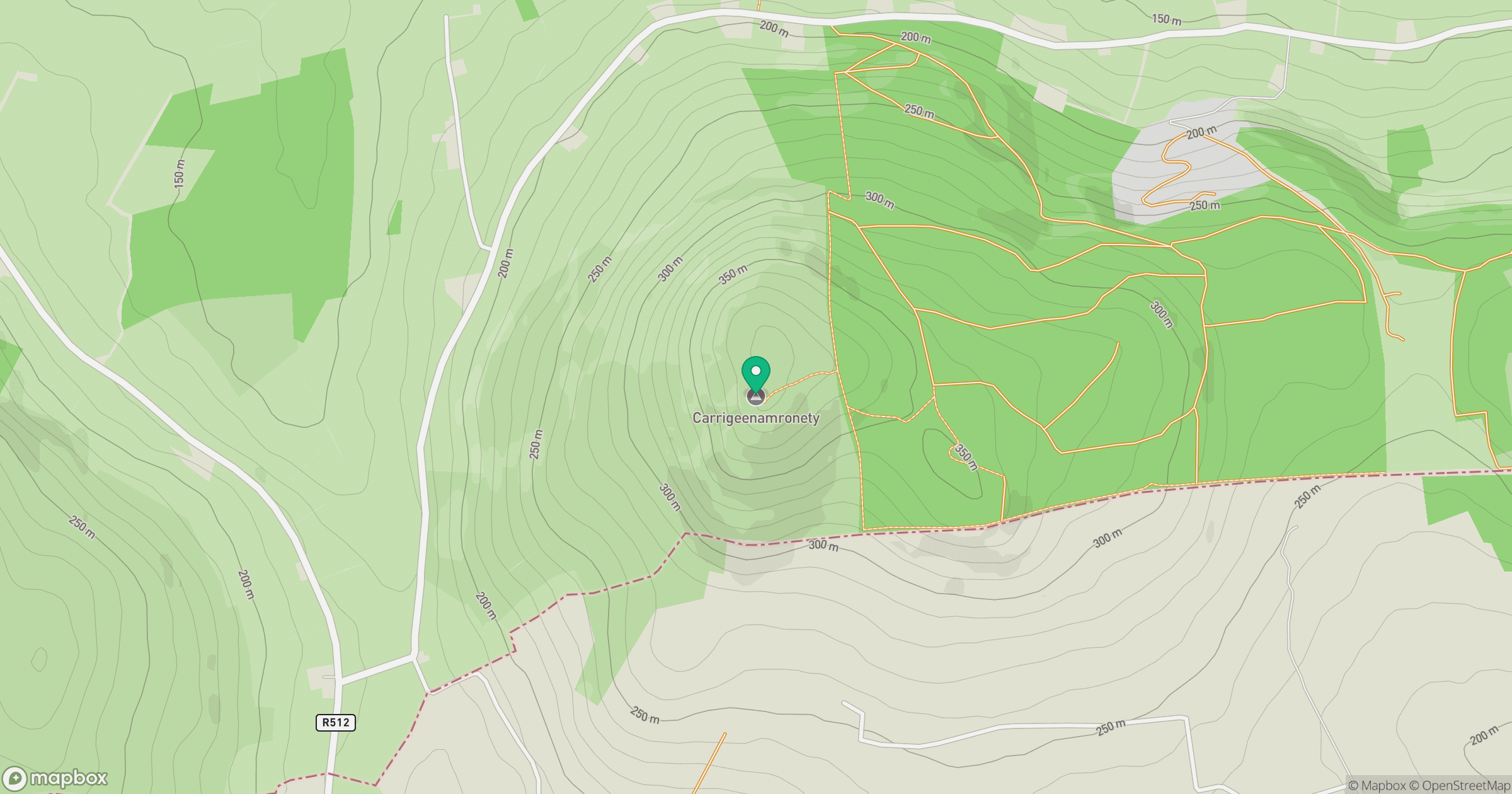
Grid reference: R700160
View on OpenStreetMapOpens a map in a new tab, centred on the hill.
Hills within 30 km
Straight-line distance, not a walking route or confirmation of access.
Galtymore [Cnoc Mor na nGaibhlte]
918m
Fear Breagach
369m
Coolfree Mountain [Sliabh Chuil Fhraoigh]
437m
Seefin Mountain W Top [Seefin Mountain] [Sui Finn]
528m
Slievereagh [The Pinnacle] [An Sliabh Riabhach]
464m
No comments yet. Be the first.